
Livermore, New Hampshire 03251
Livermore, NH Lodging, Real Estate, Travel & Visitor Information
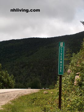
![]() Livermore, New Hampshire is rural and remote with the scenic Kancamagus Highway running through this mountain town. The average elevation here is more than 2,000 feet above sea level. More campers, moose and brooks than people – Livermore is a scenic mountain town that offers hiking, fishing and hunting. Livermore is an unincorporated civil township. Livermore – like many White Mountain area town existed briefly as a logging town in the late 19th and early 20th centuries. The rural town is located about 15 miles east of Lincoln on NH Route 112 – which is also known as the Kancamagus Highway. There are miles of hiking and mountain biking, and snowmobile trails here. Mountains include; Mount Bemis (3,706 ft or 1130 m above sea level), Mount Lowell (3,743 ft / 1,141 m), Mount Carrigain (the highest point in Livermore at 4,700 ft / 1,433 m), Mount Kancamagus (3,728 ft / 1,136 m), and Mount Osceola (4,326 ft / 1,371 m).
Livermore, New Hampshire is rural and remote with the scenic Kancamagus Highway running through this mountain town. The average elevation here is more than 2,000 feet above sea level. More campers, moose and brooks than people – Livermore is a scenic mountain town that offers hiking, fishing and hunting. Livermore is an unincorporated civil township. Livermore – like many White Mountain area town existed briefly as a logging town in the late 19th and early 20th centuries. The rural town is located about 15 miles east of Lincoln on NH Route 112 – which is also known as the Kancamagus Highway. There are miles of hiking and mountain biking, and snowmobile trails here. Mountains include; Mount Bemis (3,706 ft or 1130 m above sea level), Mount Lowell (3,743 ft / 1,141 m), Mount Carrigain (the highest point in Livermore at 4,700 ft / 1,433 m), Mount Kancamagus (3,728 ft / 1,136 m), and Mount Osceola (4,326 ft / 1,371 m).
To share any Livermore, NH information with us, please contact us. Learn more about advertising in NHLiving.
Incorporated: unincorporated
County: Grafton
Livermore, NH Population:
2010: 0
GPS Coordinates:
Latitude: 44.0428
Longitude: -71.2238
Livermore, NH Local Information
Livermore Police Dispatch: 911

inns | hotels | resorts | rentals | attractions | dining | real estate
New Hampshire Towns
NH Lodging Guide | Weddings
Products | NH Town Guides
New England Living Magazine
Free World Mall
Country Weddings | New England Recipes
NH Inns | Boston Red Sox Gifts | Travel Destinations